Connect


Contact(s)
- Learn how to read these charts on our River and stream flows page.
- This river data can be downloaded from our Data Downloads page.
Brochure
- Drayton: Preparing for Flooding - Published by the GRCA in co-operation with the Township of Mapleton and the OPP.
Critical flows
| Gauge (Community) | Flow (m3/s) | Significance |
|---|---|---|
| Upper Drayton/Drayton | 0.1 | Normal summer low flow |
| 125 | Water at banks; low-lying areas flooded | |
| 125 - 200 | Warning Zone 1 | |
| 290 | Flooding behind Wood St. homes | |
| 200 - 300 | Warning Zone 2 | |
| 370 | Water crosses Wood St. | |
| 300 - 400 | Warning Zone 3 | |
| 388 | 1974 flood | |
| 450 | Water crosses Main St. | |
| 400 - 800 | Warning Zone 4 | |
| Glen Allan | 3 | Normal summer low flow |
| 50 | Water at banks; low-lying areas flooded | |
| St. Jacobs | 4 | Normal summer low flow |
| 35 | Twp. Rd. 21 (Three Bridges Rd.) low-level bridge flooded | |
| 150 | Water at banks; low-lying areas flooded | |
| 595 | 1974 flood |
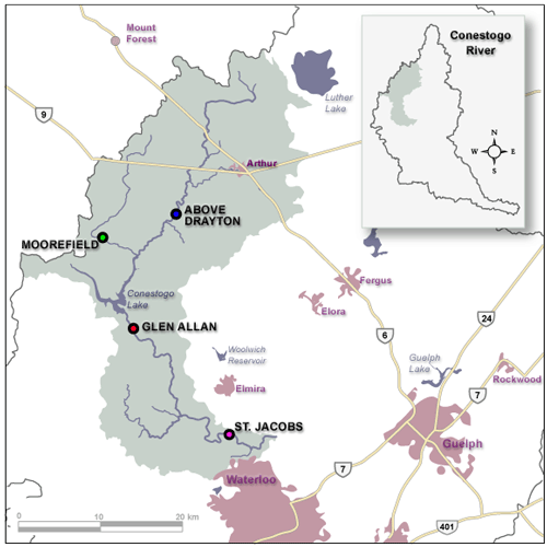
Location of flow gauges in the Conestogo River