Connect


Contact(s)
- Learn how to read these charts on our River and stream flows page.
- This river data can be downloaded from our Data Downloads page.
Critical flows
| Gauge (Community) | Flow (m3/s) | Significance |
|---|---|---|
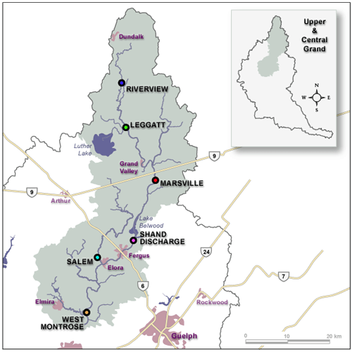
| Riverview | 0.1 | Normal summer low flow |
| Legatt (Grand Valley) | 0.5 | Normal summer low flow |
| 60 | Water at banks; low-lying areas flooded | |
| 135 | Water over CR25 | |
| 255 | Major flooding | |
| Marsville (Waldemar) | 0.8 | Normal summer low flow |
| 65 | Water at banks; low-lying areas flooded | |
| 290 | Major flooding | |
| Shand discharge (Elora) | 160 | Elora boardwalk floods |
| Salem, Irvine River | 0.3 | Normal summer low flow |
| West Montrose | 5 | Normal summer low flow |
| 125 | Campground floods | |
| Up to 180 | Warning Zone 1 | |
| 180 - 280 | Warning Zone 2; village floods | |
| 280 - 400 | Warning Zone 3 | |
| 670 | 1974 flood | |
| 400 - 700 | Warning Zone 4 | |
| 700 - 1400 | Warning Zone 5 |
Location of flow gauges in the Upper Grand River