Connect


Contact(s)
- Learn how to read these charts on our River and stream flows page.
- This river data can be downloaded from our Data Downloads page.
- Download a copy of the brochure Preparing for Flooding: A Guide for Residents of New Hamburg
- Download a copy of the brochure Preparing for Flooding: A Guide for Residents of Ayr
Critical flows
| Gauge (Community) | Flow (m3/s) | Significance |
|---|---|---|
| Nithburg | 0.2 | Normal summer low flow |
| 75 | Water at banks; low-lying areas flooded | |
| Phillipsburg | 0.6 | Normal summer low flow |
| 108 | Water at banks; low-lying areas flooded | |
| New Hamburg | 1.5 | Normal summer low flow |
| 120 | Water at banks | |
| 142 | Warning Zone 1; water on fairgrounds | |
| 175 | Warning Zone 2 | |
| 300 | Warning Zone 3 | |
| 500 | Warning Zone 4 | |
| Ayr | 2.6 | Normal summer low flow |
| 110 | Water at banks; low-lying areas flooded | |
| 142 | Water on parking lots behind Northumberland St. | |
| up to 200 | Warning Zone 1 | |
| 226 | Water at rear doors behind Northumberland St. | |
| 200 to 300 | Warning Zone 2 | |
| 300 to 400 | Warning Zone 3 | |
| 400 to 600 | Warning Zone 4 | |
| 600 to 800 | Warning Zone 5 | |
| Canning | 2.9 | Normal summer low flow |
| 120 | Water at banks; low-lying areas flooded |
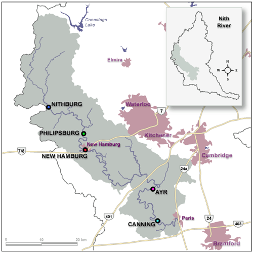
Location of flow gauges in the Nith River